Kokentau, archaeological site. Паспорт объекта
Full description
Name: Archaeological complex of Kokentau.
Site type: A group of archaeological sites from the Stone Age to ethnographic modernity.
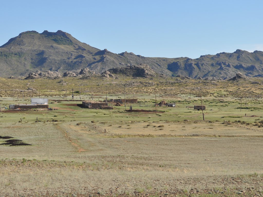
Location: The monument is located within the Semey urban district (90 km from the city of Semey) of East Kazakhstan.
The nearest settlement: The archaeological complex is located 30 km south from the Kokentau village of Semey EKR
Road: from the city of Semey to the village of Kokentau there is a paved road. There is a dirt road which leads from the village of Kokentau to the complex.
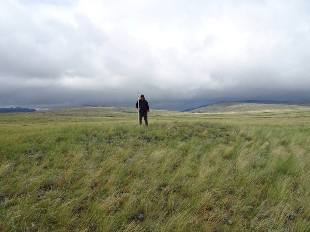
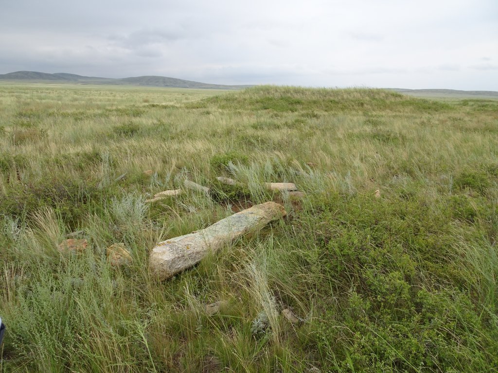
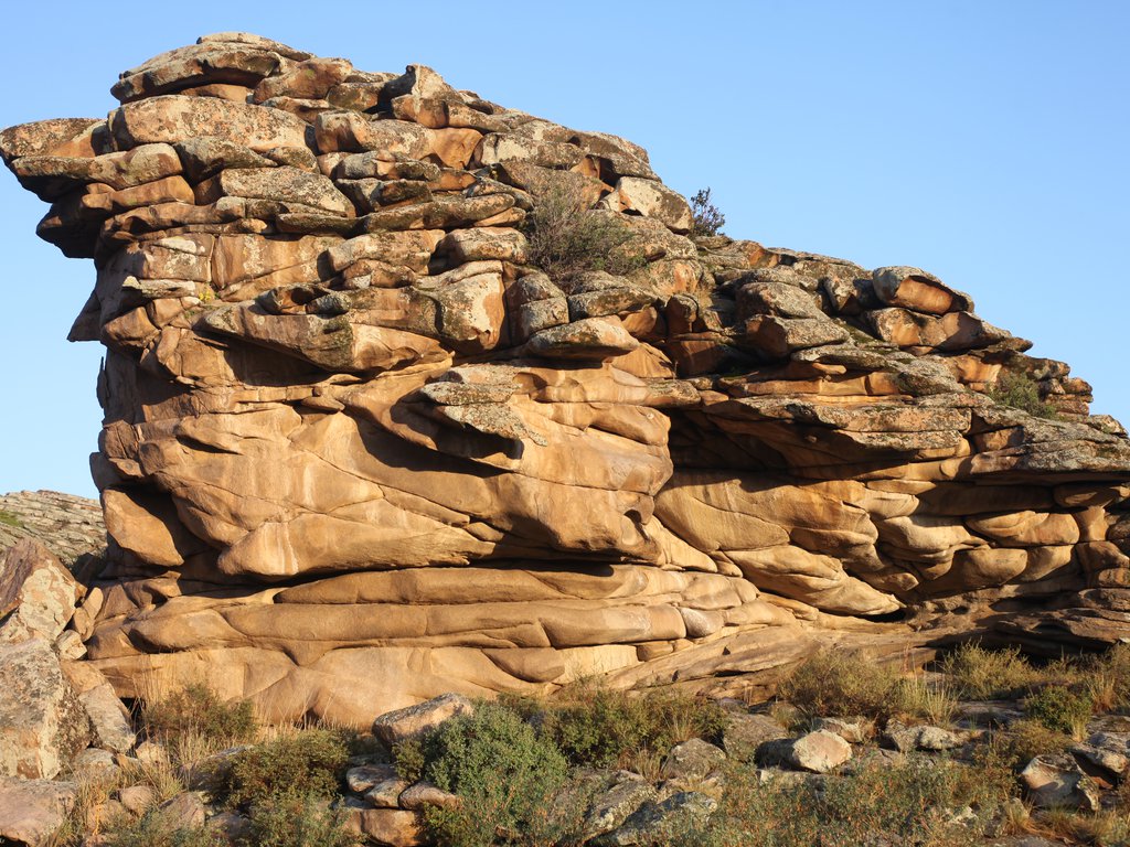
Features of the landscape: Kokentau is a mountain range, which is a natural outcrop of granitoids, which stretches from the northwest to the southeast - 15 km, and reaches a width of 10 km. Kokentau is cut off from the rest of the mountains and stands out with vertical protrusions from the surrounding steppe. The main ridge of the Ushayr (i.e., the fork) has sharp broken peaks. It is difficult to pass the mountain range from south to north. However, in the middle part of the main ridge, there is a corridor in the form of the pass -Kenasu (Wide pass). There are many sources of fresh water in the mountains, which are combined into two rivers Kuandykkarasu and Myrzabek. The soil is dry, yellowish, below 40 cm on the plains there are sand and stones on the hills. Further, below 70 cm, a continental layer in the form of white clay. In lowlands with densely growing grass and loose soil, once there was an arable land. Pine, Karagannik, meadowsweet, and wild rose grow on the hills and in hard-to-reach hollows. On the slopes and ridges of the mountain there are forage grasses such as feather grass, fescue, wormwood, beetroot, quinoa, etc.
History of the study: The first written evidence of archaeological monuments of the Kokentau mountain range is associated with the name of N. Ya. Konshin. In his article: "On the monuments of the Semipalatinsk region" he writes: "The Semipalatinsk region has been studied very little archaeologically, which, of course, is mainly due to the remoteness of the region from cultural centers. To facilitate such learning, in 1900 the Semipalatinsk Regional Stat. Committee carried out a collection of archaeological information and sent, in addition to some private individuals, to all governors of Kazakh volosts, atamans of Cossack villages and village foremen of the region ”(Konshin, 1903, p. 1.). In this article, he gives data on the inscriptions on the rocks of the Kokon mountains in the Kokenskaya volost (Konshin, 1903, pp. 4-5). The same information is duplicated in the book "Archaeological Map of Kazakhstan" (Archaeological Map of Kazakhstan, 1960.) published in 1960 for official use.
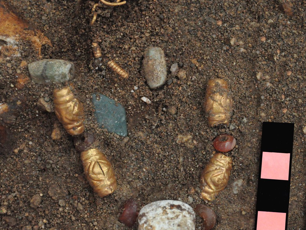
The first archaeological work was carried out in 2014-2015 by employees of the Semey detachment of the East Kazakhstan archaeological expedition of the branch of the Archeology Institute named after A. Kh. Margulan within the framework of the grant program "Antiquities of East Kazakhstan: cultural and historical processes in the Hunno-Sarmatian era". As a result, excavations of the Karatobe burial ground were carried out (Aitkali A.K. et al. 2014.). In total, during the field season, 5 stone mounds of the early nomad era were excavated (Aitkali A.K., 2014.). Surprisingly, all excavated mounds were not plundered. Thus, for the first time for this region, a unique material of the Hunno-Sarmatian time was identified; among the materials, items of inventory, consisting of gold and precious stones were especially valuable. Also, in parallel, members of the Priirtyshya local lore society were engaged in research work; they partially recorded the inscriptions of the Bronze Age made with red ocher (Iliuf Kh.Sh., 2012).
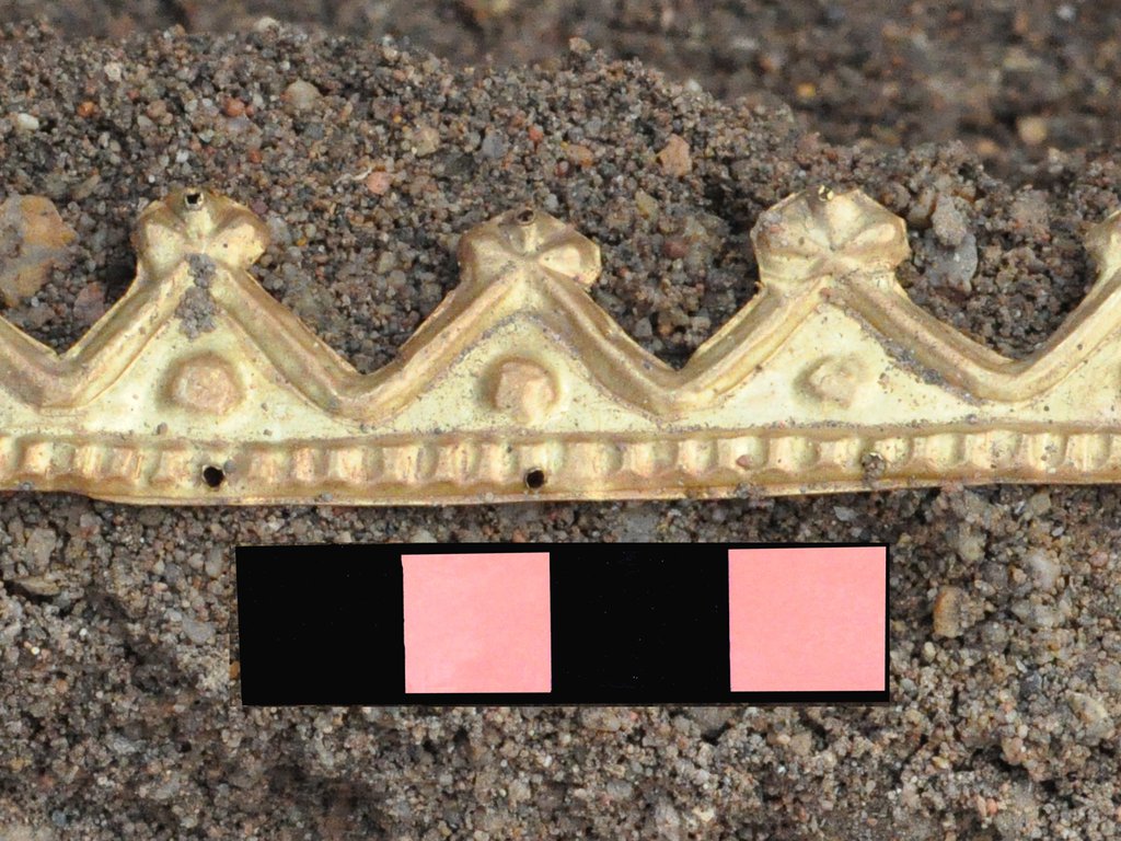
In 2017, employees of the Branch of the Archeology Institute named after A. Kh. Margulan and the Center of Historical Research named after M. Kozybayev at Shakarim University in Semey, Bronze Age fences were excavated (Aitkali A.K. et al., 2017). It should be noted that this is the first excavation of Bronze Age monuments in this area. As a result of this work, bronze earrings covered with gold leaf were found, as well as fragments of ceramic vessels (Dupuy P., 2018.). The primary results of the study of the archaeological sites of the Kokentau massif gave materials that are very interesting from a scientific point of view. It was found that the ground structure of the investigated kurgans is identical to the usun kurgans of Zhetysu, and the funeral ceremony showed a similarity with the Kulazhorgin type kurgans. Isotope analysis of bone remains showed that the diet of the ancient nomads of the Kokentau mountain range contained herbal supplements in the form of millet (Ananyevskaya, E., 2018.). In addition, seeds were found in one of the mounds, which are currently being studied by specialists from the National Center og Biotechnology (Astana).
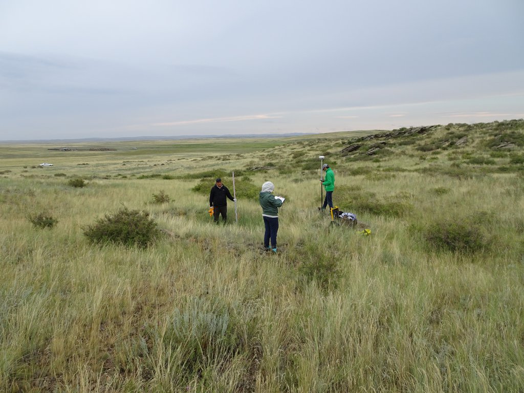
In 2018, the East Saryarka archaeological expedition of Shakarim University (Semey) studied archaeological sites of the Kokentau Mountains. As a result, a question about the Stone Age of Kokentau, on the territory of which the locations of artifacts of various functional purposes were revealed, was raised. The abundance of Neolithic microliths in this area makes it possible to further carefully study the cultures of the Stone Age of the Sary-Arka and determine the boundaries of the distribution of its cultures. Artifacts of the Mesolithic, Neolithic and Eneolithic, stone tools of the Early Bronze Age were found in the gorges and valleys of the Kokentau rivers in the areas of Koken, Khandar sayy, Zhagabaz, Karatube, etc. Burial and memorial monuments of the Bronze Age and ancient nomads were also studied. Also, in the field season of the same year, within the framework of the project "The investment potential of the sacred geography of Kazakhstan: geospace monitoring, IT technologies and historical-analysis in the production of an electronic atlas of Republic", exploration work was carried out to identify and monitor historical and cultural monuments in the archaeological complex of Kokentau. As a result of prospecting work, over 50 archaeological sites of different times and types were identified.
In the 2019 field season, within the framework of the above-mentioned project, employees of Nazarbayev University together with colleagues from Shakarim University (Semey), the University of Pittsburgh (USA) and Washington University in St. Louis (USA) excavated seven Bronze Age burials; also an exploratory excavation with the area of 24 sq. m was laid down at the settlement. As a result of archaeological work, a large amount of ceramics and archaeozoological material were obtained, as well as flakes, polished stone tools and arrowheads.
The main significant sites:
Site name: Burial ground of Karatobe
Dating of the site: The monument is dated between II century. BC – II century. AD
Location of the site: The monument is located at the foot of the northwestern end of the Mount Kokentau within the administrative district of Semey, East Kazakhstan region.
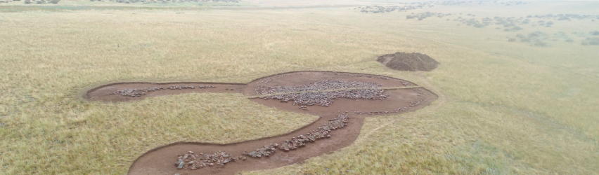
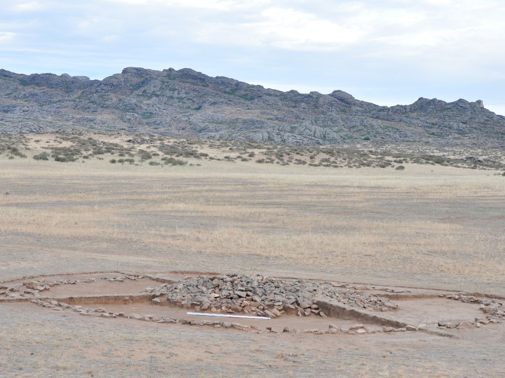
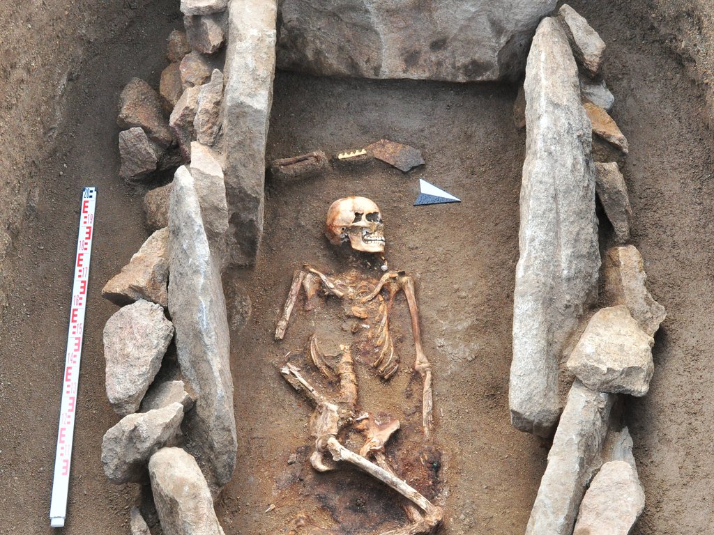
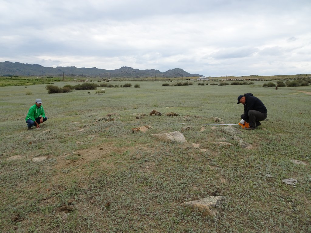
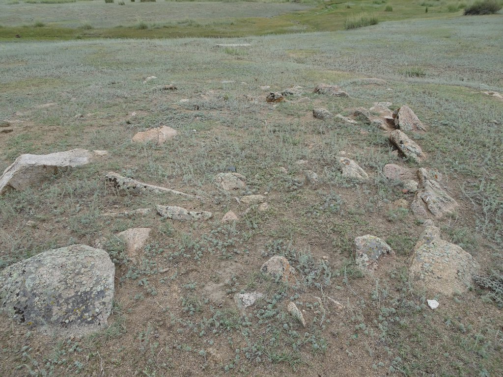
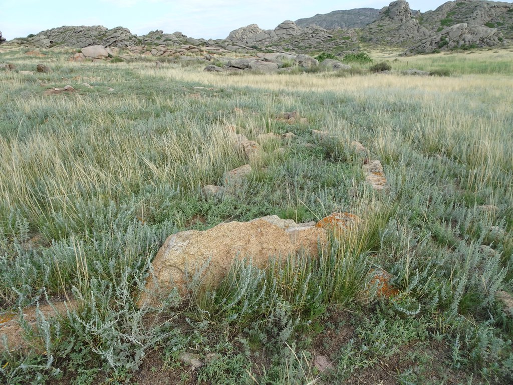
Description of the site: The monument consists of two relatively parallel chains located in the north-south direction. The number of sites in the western chain of the monument is 10, and in the eastern chain there are 6 of them. A barrow with a mustache was found in the burial ground. The western chain of burial mound consists of embankments, along the edges, where there are double circular structures, with "gates" on the NE side. These additional details are not recorded in the eastern chain of mounds. It is worth noting an interesting detail, that on the southern side of the monument, there is a stone chain that stretches across the direction of the burial ground from E to W for about 1 km.
The embankments of mounds are the same type, consisted mainly of stones mixed with earth. The diameters of the mounds did not exceed the size of 17 m. The outer rings (cromlech), enclosing the sacred space, clearly protruded onto the modern surface of the earth. There was no filling between the cromlech and the central embankment of the mounds. As noted above, entrances were located in the NE sectors of the mounds, formed by two carefully placed large stones in the break of rings.
The investigated burial mounds by the features of the ground and intra-grave buildings, accompanying inventory, and the orientation of the buried people to the west with a slight deviation to the southern sector, characterize the stable burial rite of the Karatobe burial ground. At this moment, the grave inventory is at the stage of careful study, which will help in solving a number of issues. Based on the corresponding analogy of the funeral rite, it can be said that the Kokentau region in the Hunno-Sarmatian time was one of the centers connecting the Upper Irtysh region, Zhetysu and Central Kazakhstan
Site name: Settlement of Koken
Dating of the site: The monument is dated within the 2nd millennium BC - 1st millennium BC.
Location of the site: The monument is located at the foot of the central part of the Kokentau mountain within the administrative district of Semey, East Kazakhstan region.
Site description: Dwellings were dugouts with walls reinforced with stone slabs. The lifting material is characterized by a great variety: among them there were many stone flakes, scrapers, cores, flint and bronze arrowheads, fragments of ceramics, which are represented by vessels of the Andro cultural-historical community.
Site name: Burial monuments of Sarsha, Isakhan, Biseke
Dating of the site: The monument is dated between the 1st millennium BC - 1st millennium AD.
Location of the site: The monument is located at the foot of the south and southwestern part of the Kokentau mountain within the administrative district of Semey, East Kazakhstan region.
Description of the site: A lone burial mound with a diameter of 30 m and a height of 1.5 m was discovered on the territory of the wintering of Sarsh. On the territory of the wintering Isakhan, a burial ground of 5 mounds with an earth embankment with a diameter of 8-25 m, a height of 0.3-1.3 m was discovered. A cluster of mounds was found near the Biseke burial ground, which has 30 mounds, the ground structure of which was built of crushed stones. The surface of the mounds is covered with dense vegetation. The diameters vary from 10 to 30 m, with a height of 0.3-1.5 m. On the eastern side of the embankment of one mound there is a stone stele installed. Judging by the features of the ground structure, the above-mentioned burial grounds can be attributed to the era of early nomads.
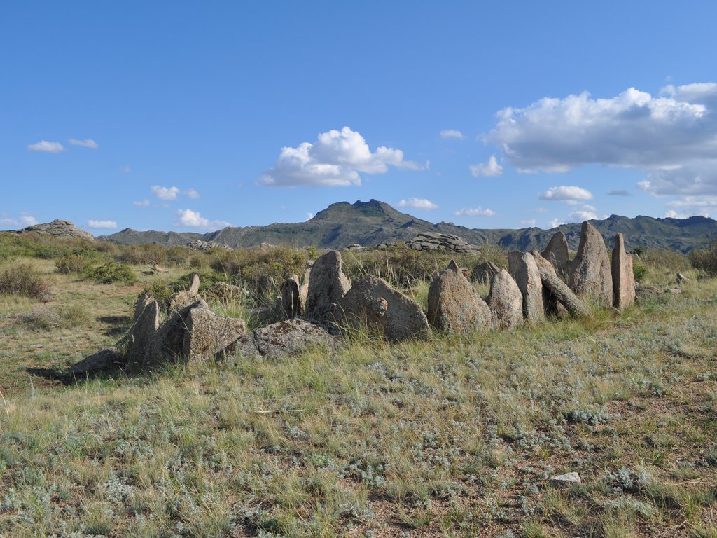
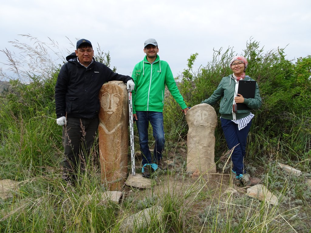
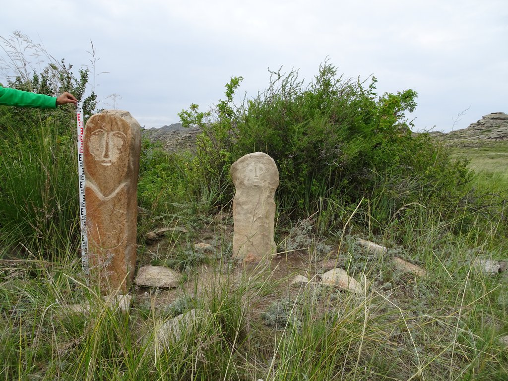
Site name: Kokentau burial complex of ancient Turkic time
Dating of the site: The monument is dated within the VI-VIII centuries AD.
Location of the site: The monument is located at the foot of the central part of the Kokentau mountain within the administrative district of Semey, East Kazakhstan region.
Description of the site: On the eastern side two adjacent fences are installed as statues. One statue is carved from red granite, where only the outlines of the face and chin lines are visible, which made the head stand out from the monolith. The second statue is smaller and made of granite of a lighter color, where the shape of the head is clearly visible, from which the face of an ancient inhabitant is carved.
Site name: Petroglyphs
Dating of the site: The monument is dated within the III-I millennium BC.
Location of the site: The monument is located at the foot of the central part of the Kokentau mountain within the administrative district of Semey, East Kazakhstan region.
Description of the site: To the north of the central part of the mountain in the rocky peaks there are many grottoes formed from granite rock. In seven of them, the ancient inhabitants of the Kokentau mountain range carved petroglyphs, the degree of preservation of which is very good, due to the location protected from the effects of natural factors.
The rock paintings are painted with ocher, which is a very rare occurrence in the Irtysh region. Similar images known to us are located on the territory of the Ak-Baur complex and near Pavlodar.
Investment recommendations: The Kokentau archaeological complex is one of the most attractive sites of historical and cultural tourism. The complex is full of unique antiquities. The fixed monuments make it possible to illuminate a rather long period in the history of this territory, numbering several millennia.
The concepts of historical and cultural tourism, which are actually implemented in the world practice, in addition to the economic (commercial) aspect, usually carry a certain ideological load. The development of historical and cultural tourism is associated with the solution of sociocultural and ideological problems. In our case, it is the preservation of the historical and cultural heritage, the preservation of the natural habitat, the revival, propaganda of the traditional way of life of ancient and modern shepherds. In the practical solution of the latter, the leading role belongs to the local community. Recently, while developing national concepts for the development of tourism in a number of European countries, the high role of local communities in the development of various areas of historical and cultural tourism has been specially noted.
Main tourist routes
Let's consider the main historical and cultural routes to the Kokentau. Historical and cultural routes are designed for all age categories, incl. for schoolchildren under the guidance of educational organizers.
Route 1: "Valley of the Kings". In the southern slope of the Kokentau mountain range there are large mounds of the aristocratic nobility of Sak tribes. Because of excellent pastures, nomadic tribes lived in this area and built their phenomenal cemeteries.
Large burial mounds dating back to the 1st millennium BC are still visible in the steppe of the southern spur of Kokentau. Local residents got used to see hills in the steppe, or, as some say, "tobe". Moreover, not everyone knows that these are monuments of cultural heritage.
Among the dozens of mounds, mound # 2 of the Karatobe burial ground stands out, where archaeologists have found archaeological artifacts of unprecedented artistic value made of gold and precious stones.
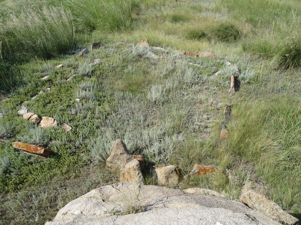
Route 2. "Ancient Sanctuary" In the western part of Kokentau in 2018 archaeologists recorded and investigated the so-called mound with a "mustache".
The stone ridges of mounds with "mustaches" at their ends are directed to the east, towards the rising sun; they carry the ritual nature and testify the presence of the cult of the sun. It is also known that stone ridges were laid out later than the burial of a person. And they can be attributed to the time of the commemoration celebrations. Thus, mound with "mustaches" are valuable both for studying the life of ancient people, the culture of their burial, and for studying their religious beliefs.
According to a number of researchers, in ancient times such complexes were used for religious and ritual activities associated with the day of the vernal equinox, i.e. "Nauryz Meiramy".
Route 3./strong> "Gallery on stones" In the central part of the Kokentau mountain, right at the foot of the Ushayr peak, grottoes are located where petroglyphs were fixed. Kokentau is the only place in the Semey Priirtysh region, where drawings made with ocher were found.
These images had a great ideological importance for people of past eras due to the fact that many petroglyphs were associated with the cults of deities and spirits; having a ritual character, they were used while performing important symbolic actions (rituals) aimed at achieving a certain goal in a supernatural way.
Route 4. “Workshops”. In the central part of the mountain range, you can see traces of a stone-cutting workshop where our distant ancestors who lived in the Bronze Age prepared stone slabs for a burial structure. Also, flakes, cores, microliths and other objects are found in mass quantities, clearly indicating the settlement of the foothill population since ancient times.
Route 5. “Settlements”. From the archaeological sites in the vicinity of the mountain, settlements of the Bronze Age and ethnographic wintering of Kazakhs from the Uak clan are known. Here you can see how ancient people built dwellings and lived there. Later, on the foundation of dwellings in ethnographic time, Kazakhs built their winterings. While digging one of the dwellings, we found fragments of ceramic vessels from the Bronze and Early Iron Age, as well as from ethnographic modernity, in various cultural layers.
Route 6. "Grave of Mukha Adilkhanuly". In the eastern part of the mountain, there is a grave of the singer, poet, composer, a student of Abai - Mukh Adilkhanuly. He was the one who acquinted the leader of the party Alash Alikhan Bokeikhanuly with the work of the Great poet Abai in Koken. Alikhan Bokeikhanuly himself wrote about this in the obituary dedicated to the death of the poet.
Recommended Sources:
Айткали А. К., Жунисханов А. С., Каирмагамбетов А. М., Ахметов М. Г., Рахманкулов Е. Ж. Предварительные результаты исследования могильника Каратобе в микро археологическом районе Кокентау в 2014 году // «Кадырбаевские чтения-2014». Материалы IV Международной научной конференции. – Астана «Мега принт»; 2014. С. 151-160.
Айткали А. Предварительные результаты исследования курганов гунно-сарматского времени могильника Котыркора в микрорайоне Кокентау // Материалы международной научно-практической конференции «VII Оразбаевские чтения» «Казахстанская археология и этнология: прошлое, настоящее и будущее», приуроченной к 550-летию образования казахского ханства, 20-летию ассамблеи народа Казахстана 28-29 апреля 2015 г. – С. – 348 - 350.
Айткали А., Жунисханов А., Бесетаев Б. Курганы второй половины І тысячелетия до нашей эры горного массива Семейтау // Саки и савроматы Казахских степей: контакт культур: Сборник научных статей, посвященный памяти археолога Бекена Нурмуханбетова. – Алматы, 2016. С. 26-33.
Айткали А.К., Жунисханов А.С., Каримов М. К., Исин А. И. Рахманкулов Е.Ж. Новые памятники эпохи бронзы горного массива Кокентау // Этнодемографические процессы в Казахстане и сопредельных территориях: Сб. науч. трудов XVI Междунар. науч.-практ. конф. 28-29 сентября 2017 г., Усть-Каменогорск. – Усть-Каменогорск: «МедиаАльянс», 2017. С. 18-23.
Ananyevskaya, E, Aytqaly, AK, Beisenov, AZ, Dmitriev, EA, Garbaras, A, Kukushkin, IA, Loman, VG, Sapolaite, J, Usmanova, ER, Varfolomeev, VV, Voyakin, DA, Zhuniskhanov, AS, Motuzaite Matuzeviciute, G. 2018. Early indicators to C4 plant consumption in central Kazakhstan during the Final Bronze Age and Early Iron Age based on stable isotope analysis of human and animal bone collagen. Archaeological Research in Asia 15:157–73.
Археологическая карта Казахстана // Алма-Ата, Издательство Академии наук Казахской ССР, 1960 г.
Дашковский П.К. Комплекс археологических памятников Айна-Булак в Верхнем Прииртышье (Восточный Казахстан): монография / П.К. Дашковский, З.С. Самашев, А.А. Тишкин. – Барнаул: Азбука, 2007. – 96 с. +вкл.
Dupuy P., Rakhmankulov E. Bronze age ceramics of the Kkoken cemetery (Sary-arka region, Kazakhstan)// «АЛТАЙ – ТҮРКІ ӘЛЕМІНІҢ АЛТЫН БЕСІГІ» Редактор – Даниал Ахметов. – Өскемен; 2018. 123-125 pp.
Коншин Н. Я. О памятниках старины в Семипалатинской области // Записки Семипалатинского подотдела Зап-Сиб. отдела ИРГО вып. І Семипалатинск. 1903. – 1-32 с.
Илиуф Х. Ш. Древности Кокентау. Материалы Международной научно – практической конференции, посвященной 70-летию музея «Роль музеев на современном этапе и перспективы развития.» Павлодар 2012, с. 29-35.
Photo gallery
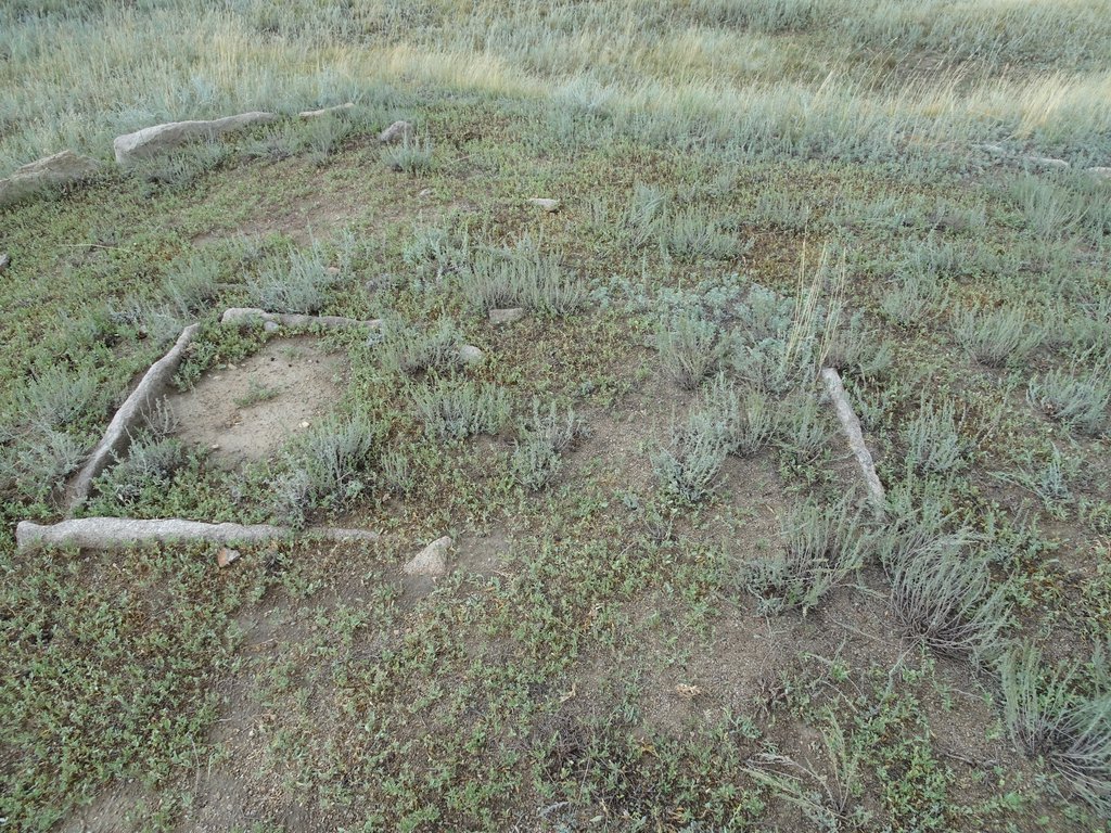
Ограда. Эпоха бронзы
Map
Materials
All materials are available at the following link